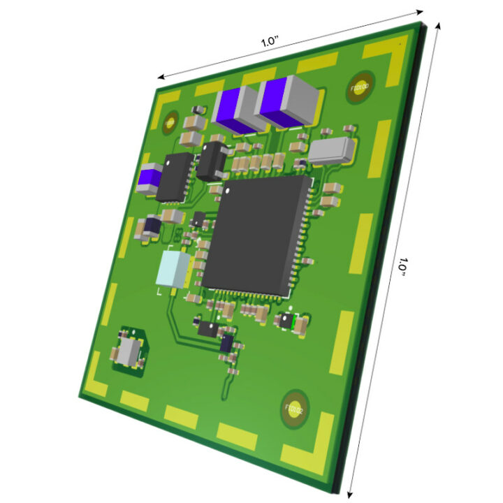
Orca Systems ORC3990 is a low-power satellite Internet of Things (IoT) SoC that works with Totum’s Low Earth Orbit (LEO) network of satellites and targets outdoor and indoor tracking and monitoring applications.
It’s not the first time we read about satellites being used for LPWAN networks, as Sigfox launched LEO satellites a few years ago to provide worldwide coverage even in remote locations like the Sahara desert, the two poles, and oceans. But I had never heard of Totum or Orca Systems before, so let’s have a closer look.
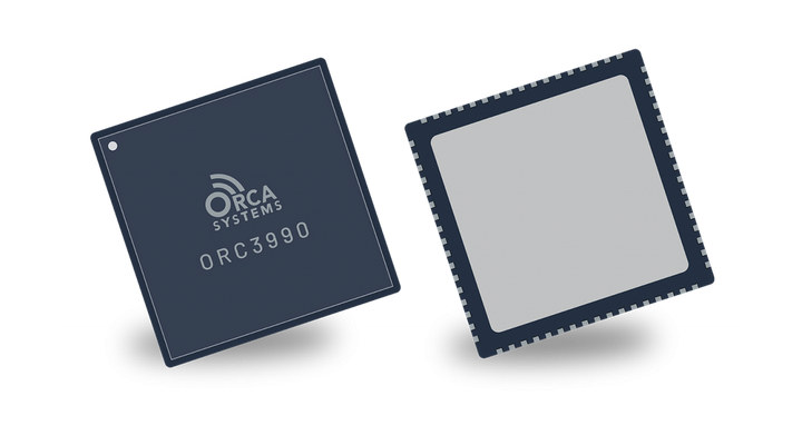
Orca Systems ORC3990
- Unnamed Arm cores
- Integrated RF Transceiver
- Low Power Sensor-to-Satellite (LP-S2S) connectivity in the 2.4 GHz ISM band
- Totum DMSS modem for improved doppler performance
- Link budget enables indoor signal coverage
- Support location fixes with 20m accuracy
- Low power – 10+ year battery life
- Package – 7x7mm QFN chip
- Temperature Range – -40 – +85°C
- Process – 22nm
That’s about all information we have about ORC3990. We’re also told via the press release that a sub-$10 endpoint solution is possible for compact tracker supporting global connectivity and positioning. More details may eventually surface on the SoC’s product page.
Totum Satellite IoT technology
We can get a better understanding of the capabilities of the solution by checking out Totum’s website where we learn some key points:
- Network comprised of 18 cubesat satellites each the size of a breadbox (6U)
- Satellite capacity – Up to 24,000 simultaneous transmissions per satellite good for millions of devices per satellite; 24 MHz spectrum
- Frequency band – Unlicensed 2.4GHz spectrum that does not interfere with WiFi or Bluetooth and is tolerant to interference from other technologies
- Support for indoor coverage with -143 dBm sensitivity, 20 dB excess link margin
- Positioning accuracy – 20 meters outdoor location accuracy, building-level accuracy indoors
- Device to Totum cloud latency of 10-15 minutes
- Low power operation
- Security
- AES 128-bit Encryption/decryption, frag/defrag, channel correction and sequencing
- Provisioning via unique MAC ID, security keys, and modem firmware
- eFUSE to prevent access after provisioning
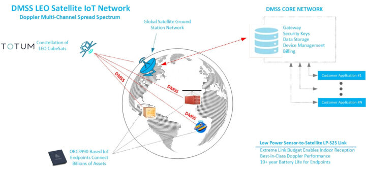
So basically the solution is for tracking applications that require low maintenance and low-cost operation, but where accuracy and real-time positioning are not critical. That would seem well-suited to container tracking for instance, as illustrated in the diagram below.
Thanks to TLS for the tip.

Jean-Luc started CNX Software in 2010 as a part-time endeavor, before quitting his job as a software engineering manager, and starting to write daily news, and reviews full time later in 2011.
Support CNX Software! Donate via cryptocurrencies, become a Patron on Patreon, or purchase goods on Amazon or Aliexpress





Do you remember On-Ramp Wireless now called Ingenu? The same guys, the same technology, they can’t deliver so they kick forward to try to engage new clients or supporters. Zero hope
I can’t remember On-Ramp Wireless, but I did write about Ingenu RPMA in the past.
But I can see Ted Myers, the CEO of Totum, was indeed co-founder at Ingenu.
I’m not sure what they are using now is exactly the same as RPMA, although it’s based on the same 2.4 GHz ISM band.
Mmmm…. “Frequency band – Unlicensed 2.4GHz spectrum that does not interfere with WiFi or Bluetooth and is tolerant to interference from other technologies”
How do you not interfere with other WiFi and Bluetooth which use the same band (along with Zigbee, Matter and a bunch of other wireless technologies)?
Additionally the 2.4 GHz band is limited to 100 mW EIRP in many places, that probably makes it quite a challenge to reach a satellite a few hundred km away from an indoor location. At a distance of 500 km the received signal at the satellite is only -133 dBm with line of sight, so even with a -143 dBm sensitivity that doesn’t leave much margin for indoor operation. It’s less of a problem on a ship in the middle or the ocean, or in the US and other regions with more generous EIRP limitations, but they’re apparently targeting global coverage, so you are limited by the strictest regulations.
I hope the “24,000 simultaneous transmissions per satellite” over a 24 MHz bandwidth don’t mean a 1 kHz bandwidth per device, otherwise it’s going to be even slower than LoRa which is already pigeon-like.
Also, how do they get global positioning coverage with just 18 LEO satellites? All existing global positioning systems use 24+ MEO satellites (and you need a lot more satellites at lower altitudes). I’m not even sure they can actually achieve global data coverage with just 18 LEO satellites, but the idea may be that the device waits for a satellite to pass overhead to transmit (or repeats transmissions until a satellite passes overhead), which would explain the “_Device to Totum cloud latency of 10-15 minutes_”. Or maybe that’s the time for the satellite to be able to reach a ground station (which implies buffering and thus more complexity in the satellite)? Or maybe both…
Has anyone actually found their satellites? I can’t seem to find them in any database, though they may be under a different name. The only source I found which mentions them says they are not launched yet (planned for this year).
It may all be a very good thing in the end, but there are quite a few challenges on which clarification is needed before one could agree on whether it will actually work in real life and what applications is is suitable for. Of course, at this time, the constraints given already limit the applications (non time-sensitive, probably extremely low bandwidth, so mostly long-distance asset tracking).
I share the same concerns with Jacques
Apparently, they have gotten it to work by testing with the YAM satellite. Though it is impossible to find any performance data. I also have some concerns that interference from other radio traffic and the PL >155dB will make it challenging unless the situation is perfect.